
Empowering reforestation efforts through advanced Geographic Information Systems

Mining sustainably for a greener future and responsible resource management

Boosting productivity with real-time crop monitoring, data insights, and precision farming.
With decades of experience in implementing IT solutions for governance, monitoring, management and decision support our offerings can be categorized into
Transforming business models by implementing cultural and organizational changes, adopting data-driven decision-making, and developing a customer-centric organization.
years of experience
Objective based monitoring and management of projects adopting satellite remote sensing and geographic information system enhancing visualization & transparency.
satisfied clients
Implementation of innovative solutions with technology integration – AI/ ML, Blockchain, Big Data, Cloud computing, Satellite Remote Sensing, IoT to deliver value to customers.
project completed
Transforming industries with efficiency, sustainability, and innovation.

Transform mining operations with precision mapping, resource estimation, and real-time monitoring solutions that enhance safety, efficiency, and environmental compliance.

Leverage advanced GIS solutions to optimize forest resource management, track biodiversity, and make data-driven decisions for sustainable woodland conservation and planning.

Revolutionize farming practices with smart mapping technology, crop monitoring, and precision agriculture tools for maximizing yields and sustainable resource management.

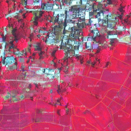
Streamline land administration and planning with comprehensive GIS tools that integrate cadastral mapping, zoning analysis, and property management into one platform.
We specialize in developing innovative software solutions for resource management, decision support, and inventory systems, enabling efficient and sustainable practices across various domains


SPARC's solution has led to direct savings of approximately $500 million USD by utilizing satellite image-based validation since the monsoon crop season of 2021-22. This system has prevented the procurement of inflated claims totaling 2 million metric tons of paddy over the last five crop seasons.
SPARC partnered with the state government to provide a solution for high-precision identification of forest parcels using IT, GIS, Remote Sensing, and Differential GPS technologies. It covered notified forest blocks, unclassed forest areas, national parks, sanctuaries, eco-sensitive zones, compensatory afforestation lands, and lands diverted for non-forest use.
Additionally, it helped create a unified database, reducing discrepancies across different governmental agencies and thereby enhancing transparency and accountability.
SPARC implemented an innovative Land Rights Grant Management System to facilitate the world’s largest land records titling program. Thus granting non-transferable but heritable and mortgage-able land rights in different urban areas. This required transparent and time-bound assessment of land occupancy for around 500,000 households across 3000 slums in 114 urban local bodies.
SPARC's solution incorporated GIS mapping for each permit, analyzing route overlaps and service frequency to identify areas lacking public transport. The system utilizes collected data to develop a District Transport Master Plan, recommending improvements such as route extensions and decongestion measures.
sharing expertise on innovative technologies, sustainable practices, and industry trends to inform and inspire diverse audiences.
We empower you with tailored solutions by harnessing location-based data through advanced geo-spatial & IT/GIS technologies.

Deliver customized software solutions from concept to deployment, integrating cutting-edge technologies to transform your business operations and drive digital innovation.

Transform spatial data into actionable insights with comprehensive mapping, analysis, and visualization services tailored to your organization's unique requirements.

Provide expert guidance through digital transformation journeys, offering strategic insights and technical expertise to optimize your technology investments and outcomes.

Connect organizations with skilled technology professionals, ensuring the right talent meets your project needs while maintaining flexibility and technical excellence.
write to us