

Challenge
Industrial growth is essential for economic development, but it also increases pressure on air quality, water resources, land, and surrounding ecosystems. Environmental regulators often manage large volumes of monitoring data from multiple sources, making it difficult to identify pollution hotspots, evaluate cumulative environmental impacts, track compliance, and prioritize regulatory actions. Fragmented information and limited spatial context reduce the effectiveness of environmental monitoring and decision-making.
Solution
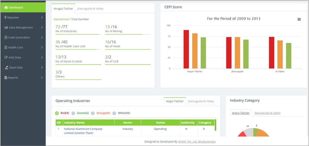
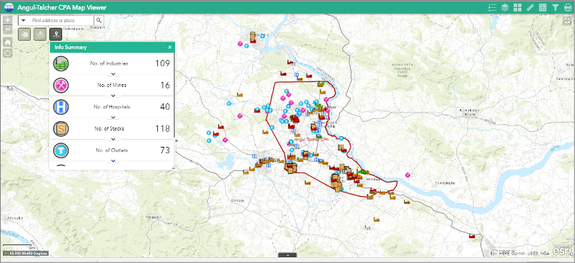
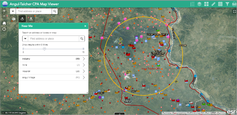
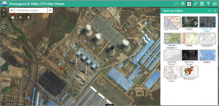
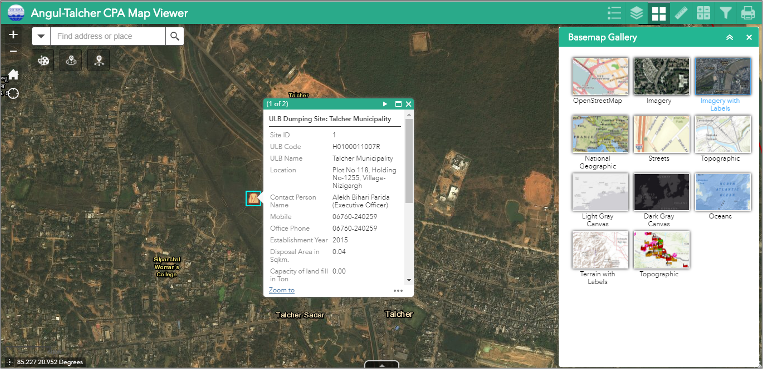
SPARC implemented a comprehensive GIS-based Environmental Monitoring and Decision Support System for State Pollution Control Board that integrates industrial inventories, environmental monitoring stations (air, surface water, ground water, sediment & noise), satellite imagery, water bodies, drainage, land use, transportation networks, and regulatory information into a unified geospatial platform. Interactive dashboards and spatial analytics enable environmental agencies to monitor pollution-prone industrial areas, assess environmental trends, identify compliance risks, visualize monitoring data, and support evidence-based inspections and enforcement. Mobile-enabled field verification and centralized reporting provide regulators with timely, location-specific environmental intelligence for more effective environmental governance.
Outcome
The platform has strengthened environmental oversight by providing a single source of geospatial intelligence for monitoring industrial ecosystems and regulatory compliance. It has improved the identification of pollution hotspots, accelerated environmental assessments, enhanced transparency in regulatory processes, and enabled faster, data-driven decision-making. The scalable solution supports sustainable industrial development, ESG reporting, environmental risk management, and long-term ecological stewardship, making it readily adaptable for environmental agencies and industrial regulators worldwide.
Highlights
This project demonstrates how geospatial intelligence can modernize environmental governance in industrial regions by integrating diverse environmental datasets into a single decision-support platform. By combining GIS, satellite imagery, spatial analytics, and regulatory workflows, SPARC has delivered a scalable solution that helps governments and regulators balance industrial growth with environmental protection. The solution aligns with global priorities around ESG, environmental compliance, sustainable industrial development, and climate resilience, making it applicable to industrial corridors, manufacturing hubs, mining regions, and environmental agencies.
Relevant Industries / Sectors
- Environmental Protection & Regulation
- Industrial Manufacturing
- Mining & Metals
- Oil & Gas
- Chemicals & Petrochemicals
- Energy & Utilities
- Environmental Consulting
- ESG & Sustainability
- Climate & Environmental Risk Management
- Government & Public Sector
- Smart Cities
- Infrastructure & Industrial Development
- Water Resources Management
- Public Health & Environmental Assessment