

Challenge
Water utilities are under increasing pressure to deliver reliable, equitable, and sustainable services while managing aging infrastructure, expanding urban populations, and rising customer expectations. Many utilities rely on fragmented records for pipelines, valves, reservoirs, service connections, and consumer information, making it difficult to locate assets, respond to outages, reduce water losses, plan maintenance, and deliver efficient customer services. The lack of a unified spatial view also limits operational visibility and long-term infrastructure planning.
Solution
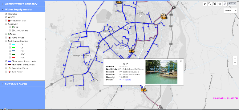
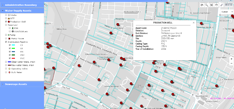
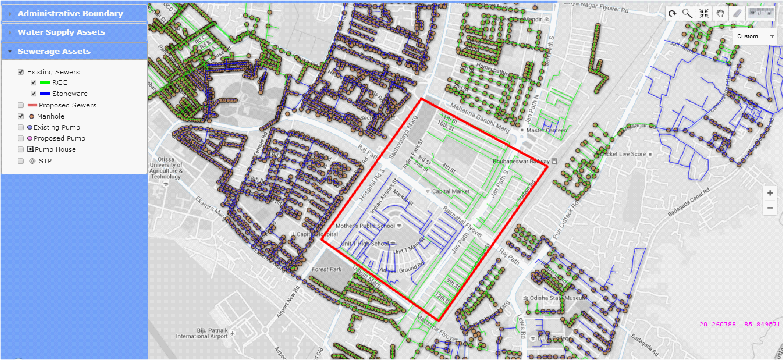
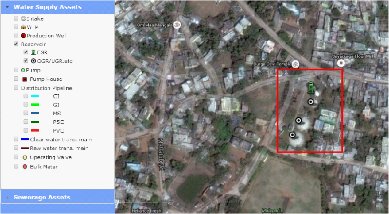
SPARC implemented a comprehensive WebGIS-based Water Utility Asset Management System for Bhubaneswar & Cuttack twin-cities that integrates utility assets, distribution networks, customer connections, meters, service zones, and operational data into a single geospatial platform. The solution creates a digital inventory of water infrastructure and consumer locations, enabling utilities to visualize network assets, manage maintenance activities, monitor service coverage, identify operational gaps, and support informed investment decisions. Interactive dashboards, mobile field applications, and GIS-enabled workflows improve asset inspection, customer service, infrastructure planning, and operational coordination while providing utility managers with real-time spatial intelligence.
Outcome
The platform has significantly improved the visibility and management of water utility assets by replacing fragmented records with an integrated digital system. Utilities can now respond more quickly to service disruptions, optimize maintenance planning, strengthen asset lifecycle management, and improve customer service through accurate consumer mapping. The solution supports reduction of operational inefficiencies, enhances infrastructure resilience, and establishes a scalable digital foundation for smart water utilities, digital twins, and sustainable urban infrastructure management.
Highlights
Water utilities worldwide are transitioning from paper-based asset records to data-driven, intelligent utility operations. This project demonstrates how WebGIS can serve as the digital backbone of modern water utilities, integrating infrastructure assets, customer information, and operational workflows into a single source of truth. By enabling better asset management, faster maintenance response, improved service delivery, and long-term infrastructure planning, the platform supports key priorities for utilities, including resilience, operational efficiency, non-revenue water reduction, digital transformation, and customer-centric service delivery.
Relevant Industries / Sectors
- Water Utilities
- Water & Wastewater Infrastructure
- Municipal Governments
- Smart Cities
- Public Utilities
- Infrastructure Asset Management
- Utility Engineering
- Environmental Services
- Urban Infrastructure Planning
- Digital Government (GovTech)
- Operations & Maintenance
- Engineering Consulting
- Sustainable Infrastructure
- Climate Resilience & Water Security