
Challenge
Public transportation agencies face increasing pressure to provide safe, efficient, and equitable mobility while managing complex permit processes, route planning, regulatory compliance, and growing commuter expectations. Traditional permit administration often relies on fragmented records, manual approvals, and limited spatial analysis, leading to route duplication, scheduling conflicts, underserved communities, and inefficient allocation of transport resources. The lack of integrated digital systems also limits transparency and restricts access to real-time information for operators, regulators, and passengers.
Solution
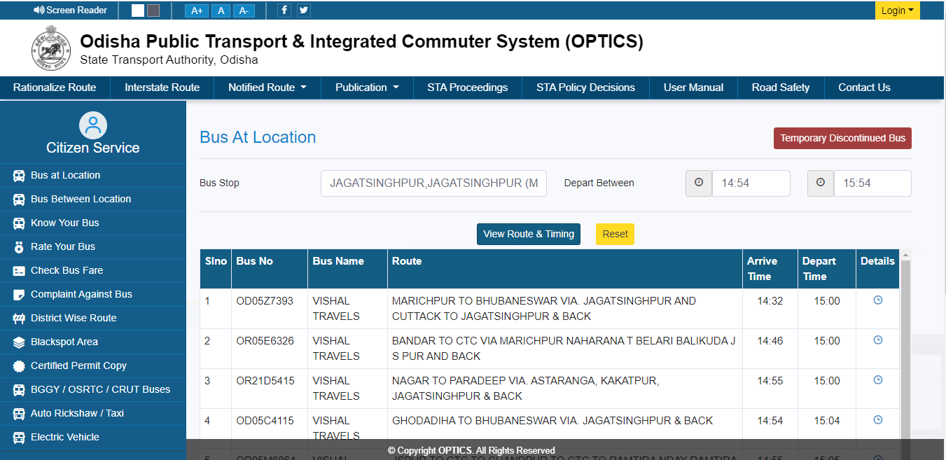
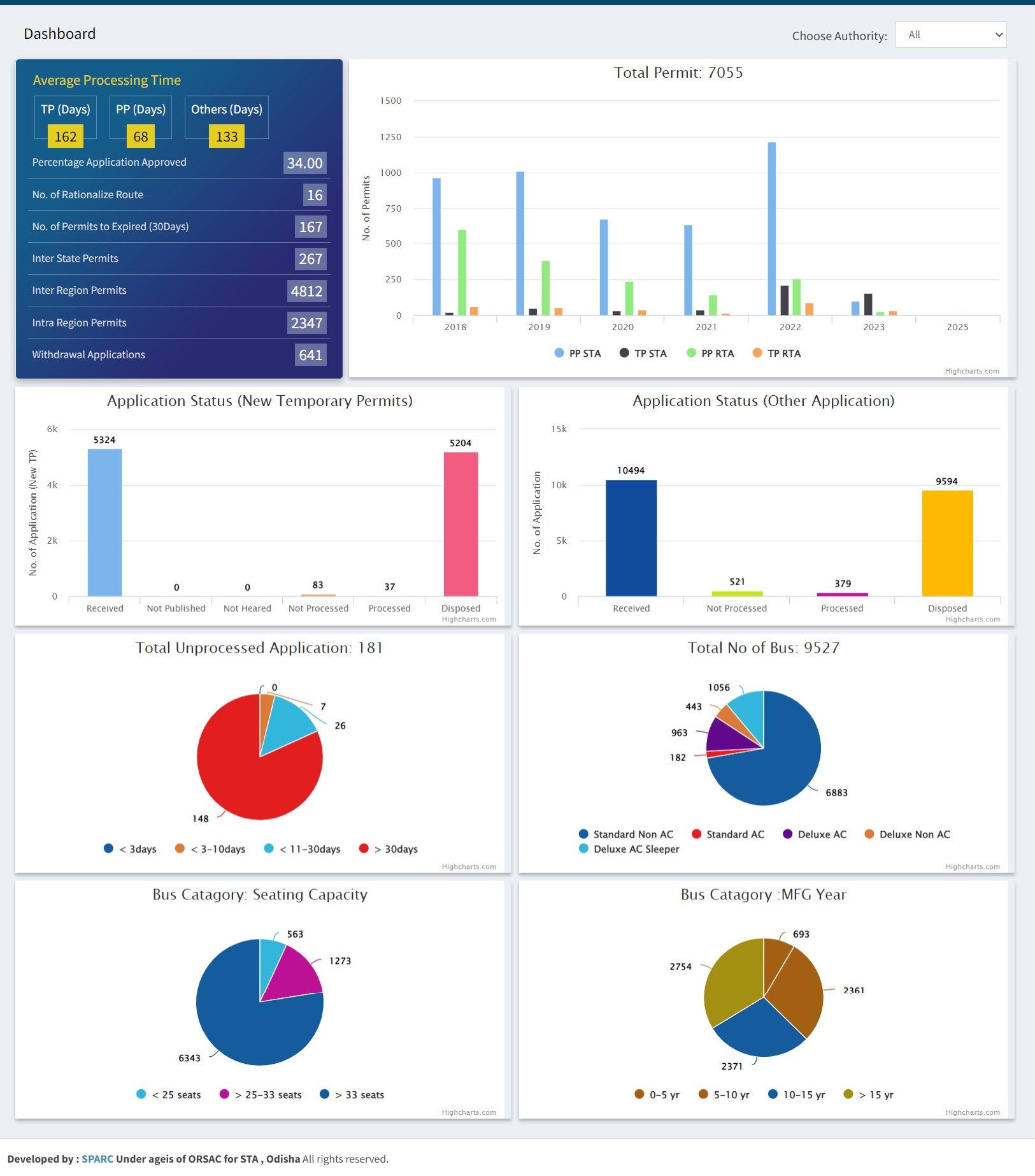
SPARC developed an integrated GIS-based Public Transport Planning & Permit Management Platform that digitizes the complete lifecycle of public transport permits—from application and evaluation to issuance, renewal, compliance monitoring, and performance analytics. Built on an enterprise WebGIS architecture, the platform integrates transport routes, road networks, bus stops, demographic data, demand centers, and regulatory databases into a unified digital ecosystem. Spatial analytics support route rationalization, conflict detection, service-gap analysis, and transport master planning, while automated compliance checks ensure vehicles meet regulatory requirements before permits are approved. Dedicated web and mobile applications provide real-time services for transport authorities, operators, and commuters, including route search, fare information, service feedback, permit tracking, and operational dashboards.
Outcome
The platform has transformed public transport governance by replacing manual processes with transparent, data-driven workflows. It has significantly reduced permit processing time, minimized scheduling conflicts through automated route validation, improved regulatory compliance, and strengthened evidence-based transport planning. Citizens benefit from improved access to route information and digital services, while transport agencies gain real-time operational intelligence to optimize networks and extend mobility to underserved communities. Designed as a scalable digital mobility platform, the solution is readily adaptable for regional transit authorities, metropolitan transportation agencies, and smart city programs worldwide.
Highlights
As cities and regions worldwide seek to modernize public transportation, integrating geospatial intelligence with digital governance has become essential for building efficient, equitable, and sustainable mobility systems. This project demonstrates how a unified platform can seamlessly combine permit management, spatial planning, regulatory compliance, operational analytics, and citizen engagement into a single digital ecosystem. Its modular architecture and standards-based design make it readily transferable to regional transit authorities and smart mobility initiatives. It highlights SPARC's capability to deliver enterprise-scale mobility solutions that improve operational efficiency while enhancing the commuter experience.
Relevant Industries / Sectors
- Intelligent Transportation Systems (ITS)
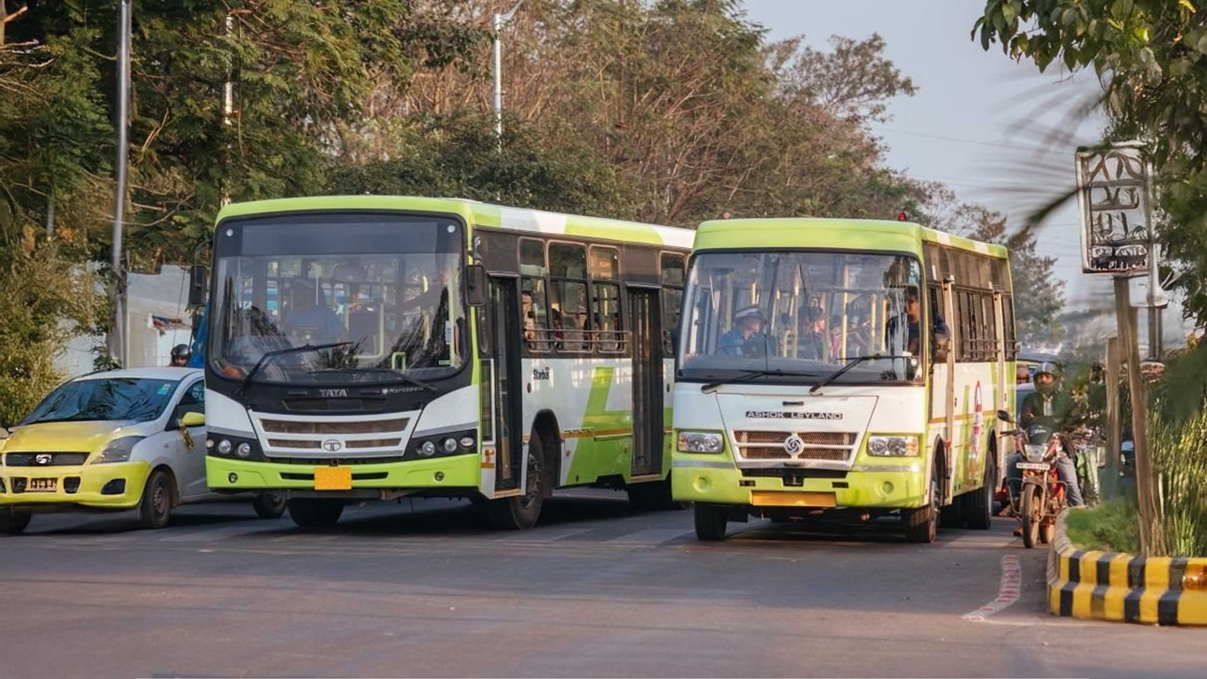
- Public Transportation
- Smart Cities
- Government & Public Sector
- Urban & Regional Mobility Planning
- Road & Highway Authorities
- Infrastructure & Transportation Consulting
- Logistics & Fleet Management
- Mobility-as-a-Service (MaaS)
- Digital Government (GovTech)
- Urban Planning
- Public Safety & Regulatory Compliance
- Sustainable Transportation
- Digital Infrastructure